Words & Photos: Mark Stevenson
Additional reporting: Emily Carlill
In the 1840’s the land that stretches from roughly where Benjamin Gott High School was to where Armley Primary School is (Gotts/Armley Park today) was mostly owned by members of the Gott family and occupied by John Tattersall.
Tattersall is on the census of 1851 as being a farmer at RedCote in Armley and by 1861 he was a farmer of 60 acres, employing four men living at Pasture Hill Farm. Pasture Hill is the hill that leads down to the Leeds and Liverpool Canal, and Redcote and Pasture Hill Farm may be the same place.

In the 1840’s at least five footpaths were leading on to the Gotts/Tattersall land.

All lead down to the canal from either Armley Ridge Road or Stanningley Road. All, I assume, had no street lighting (all but one still have no street lighting today). On dark winter mornings and nights, it would’ve been walked along (rush hour) by hundreds of people each day to and from work.

So out of these five footpaths why is only one of them called Lantern Lane?
The only explanation that I have been able to find is this:
“it was part of an old right of way which ran from Brown’s Field of Pasture’s Farm to Redcote. From the early 19th century many people with homes in Armley walked to their employment in the mills of Burley via Lantern Lane. It got its name as it was very often dark on the winter mornings and evenings and the workers had to carry lanterns to light their way. It was known locally as o’t Lantern Hoil. It was necessary to cross the River Aire by way of ‘Halfpenny Bridge’ as it was called by local people”.
Words from Leodis.

If you start from the footpath near Armley Ridge Road – where the West Leeds Activity Centre is now – you would’ve been able to walk down it to the canal and crossed Thompson’s Bridge (long since gone) then carried on through the field where you would’ve come to the Tattersall Bridge (Tattersall Bridge may still be there but the area at the far corner of the Electricity Station, near Kirkstall Nature Reserve, is too overgrown to see).

The rest of the footpaths lead off from Stanningley Road. Redcote Lane (the only footpath to have an official name). The next is just a few metres further down the road. This one cuts across Lantern Lane following Pasture Hills and goes to Airegate (Canal Road).
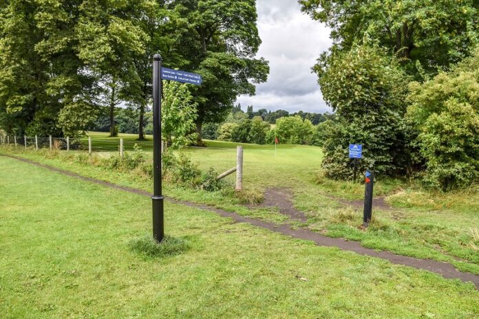
The fourth one is Lantern Lane itself. Most of Lantern Lane has long gone but parts of it remain. It would have run from Stanningley Road across the play area of Armley Park where the swings are, cut across the footpath mentioned above and connected to Redcote Lane.

The last started near Armley Lodge and connected to the Pasture Hills footpath. This last footpath is still there today but is now the ginnel running down along Rombolds and other streets at the end of the park.
Many people who use these footpaths in Gotts/Armley Park are not aware that they are at risk of becoming blocked over the coming years.
They could be taking their children to school one day and find their way closed by a private fence or new housing development. These are often not paths that have been forgotten about and overgrown but are paths that are used every day.

Unlike many paths in the outer regions of Leeds, these more inner-city paths have not been made ‘definitive’ by Leeds City Council, meaning they are not recorded on Leeds City Council’s official Definitive Map of Rights of Way.
Residents have until 2026 to record these paths before they are lost. At least 20 people need to have walked and notified the council that it is in use through submitting a ‘Public Rights of Way Evidence Form’ to allow the path to be officially recorded.
West Leeds Dispatch recently reported on how local residents had formed a group to save Kirkstall’s footpaths from being blocked.
For more West Leeds history, check out more of the Mark’s History column here.


It would be a pity if these paths were ever to become blocked. We owe it to future generations to ensure that they are officially registered as definitive rights of way. Let’s not leave it too late.
There is also a path from Armley Ridge Rd at the bottom of the Rose Garden that follows inside the walls round the back of Stanningley Rd allotments, through the wood and joins Redcote Lane near the bottom. Plus “the Ridge” (once spelt Rigg) runs parallel to Stanningley Rd and was probably the drovers track into Leeds. It is still distinguishable as raised hard ground but is is now fenced off just inside the golf course – walk from Stanningley Rd Allotments site through gap in hedge towards Leeds staying on the high ground between the trees on Golf course side ending by Armley Park.